Thinking about a move to Chandler? You’re not alone. This East Valley city blends a strong job market with easy freeway access and a full lineup of parks, shopping, and dining. If you want practical details on commute times, work hubs, and the amenities you’ll use most, you’re in the right place. Let’s dive in.
Why Chandler appeals
Chandler sits in Maricopa County within the Phoenix–Mesa–Scottsdale metro area. According to the 2020 U.S. Census, the city’s population was 275,987. Growth has tracked with technology and semiconductor employers that anchor local jobs and attract professionals.
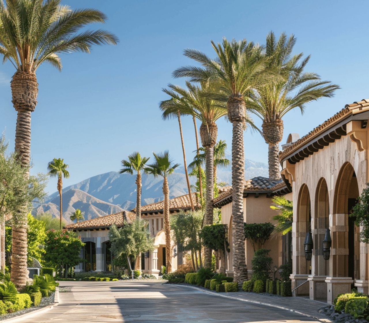
You’ll find a mix of historic, walkable blocks near Downtown and newer master-planned communities across the city. Many residents choose Chandler for its proximity to East Valley employers, regional freeways, and a broad amenities list that fits everyday life.
Commute basics and drive times
Car travel is the dominant mode across the East Valley. Many residents commute northwest toward Tempe and central Phoenix, north toward Mesa and Tempe, or stay local within Chandler and Gilbert. Hybrid and remote work schedules are common in tech and corporate roles, which helps spread peak traffic.
Typical one-way drives to Tempe or Downtown Phoenix range from about 20 to 45 minutes. Your exact time depends on your starting point, route, and rush-hour conditions.
Freeways and arterials to know
- Loop 202 is the primary east–west connector across the East Valley. It links to US‑60 and I‑10 for trips into central Phoenix.
- I‑10 offers a direct corridor to Downtown Phoenix and the West Valley.
- US‑60 connects to Mesa and Tempe.
- Expect peak-hour congestion on Loop 202 and along Price Road, Dobson Road, Alma School Road, Arizona Avenue, and Chandler Boulevard. Traffic along Price Road tends to increase during shift changes at major employers.
Transit and other options
- Light rail does not currently extend into Chandler. Riders heading to Tempe or Phoenix often drive or take bus connections to rail stations in Tempe or Mesa.
- Valley Metro bus and some express routes serve major corridors, including peak-hour options to Tempe and Downtown Phoenix. Coverage is strongest along arterials.
- Bike lanes and multi‑use paths exist in select corridors. Summer heat limits mid-day riding for many people, so early morning and evening hours are more practical.
- Rideshare and, in some cases, employer shuttles provide added flexibility.
Airport access
- Phoenix Sky Harbor International Airport is typically 20 to 40 minutes away by car, depending on traffic and your neighborhood.
- Phoenix–Mesa Gateway Airport in Mesa is closer for parts of southeast Chandler and serves select commercial routes.
Major work hubs
Chandler’s job base is a standout. Technology and semiconductor operations sit alongside aerospace and defense, advanced manufacturing, healthcare, education, retail, and professional services. This mix creates both local commutes and strong reverse‑commute patterns into the city.
Key employment clusters include the Price Road corridor in northwest Chandler, the Ocotillo area, and business parks along Loop 202. Downtown Chandler supports municipal services, retail, dining, and small businesses. Startups benefit from nearby university resources and co‑working options across the East Valley.
Where short commutes are common
If you want to cut drive time, focus on neighborhoods near Price Road, Ocotillo, and Loop 202. North and central Chandler generally offer quicker access to Tempe and Downtown Phoenix than the southern edge of the city. Always map your route during your typical commute window to gauge real-time traffic patterns.
Neighborhoods and lifestyle
Chandler’s neighborhoods offer a range of home styles and daily rhythms. You can choose a historic area near restaurants or a planned community with lakes and golf.
- Downtown Chandler. A walkable core with restaurants, breweries, arts venues, and a regular calendar of events. Historic blocks nearby offer convenient access to dining and nightlife.
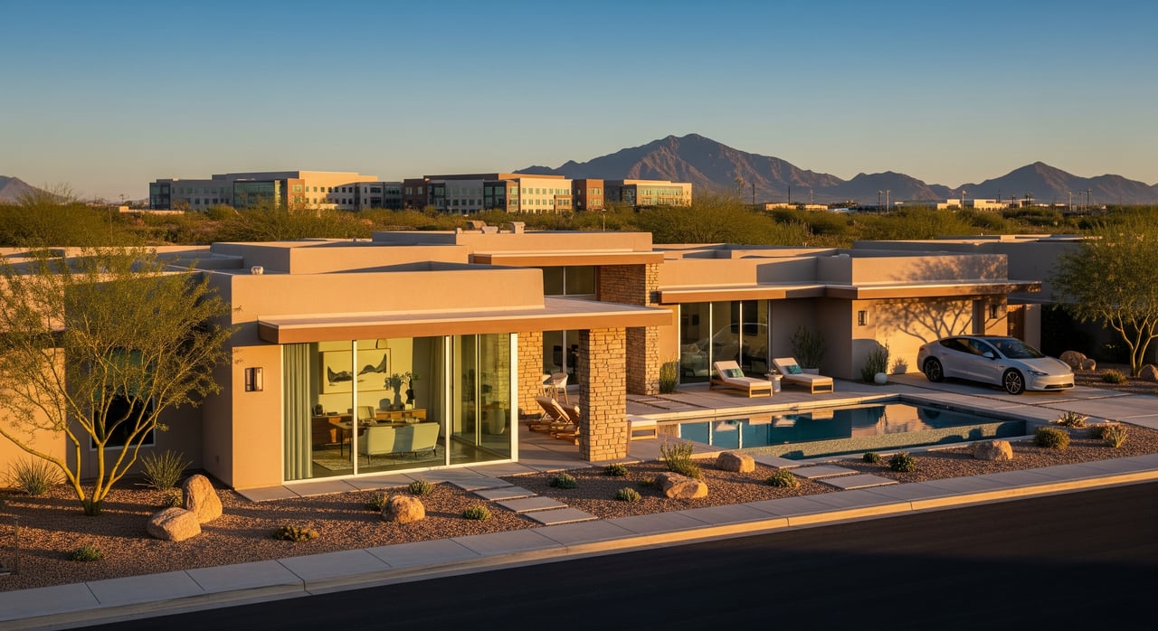
- Price Road and North Chandler. Newer suburbs with a high share of single‑family homes and convenient freeway access. Popular with residents who value proximity to job hubs.
- Ocotillo and Fulton Ranch. Planned communities with parks, lakes, golf, and community amenities. Homes often come with HOA access to pools or recreation spaces.
- South Chandler and Sun Lakes. Established neighborhoods with a quieter pace. Sun Lakes is a large 55+ community near the southern boundary.
Amenities you will use
Chandler makes everyday living easy with parks, shopping, and healthcare nearby.
- Parks and trails. Tumbleweed Park and Veterans Oasis Park are among the city’s notable destinations, with playgrounds, fields, trails, and a nature area for wildlife viewing.
- Recreation and golf. You’ll find public and private courses in and around the city, plus community centers and aquatic facilities.
- Shopping and dining. Chandler Fashion Center anchors major retail on the north side, while Downtown Chandler offers restaurants, local shops, and festivals that change year to year.
- Arts and culture. Theaters, galleries, and public art add to a growing creative scene.
- Healthcare. Regional hospital systems and specialty clinics serve the East Valley, with facilities within a short drive of most neighborhoods.
Schools and education
Chandler Unified School District is one of Arizona’s larger districts. School ratings and programs vary by campus, and attendance boundaries can change. If schools are important to your move, verify current boundaries and the latest performance reports for individual schools.
For higher education, Chandler‑Gilbert Community College operates nearby, and Arizona State University’s Tempe and Polytechnic campuses are a short drive away. These institutions support a steady flow of student, faculty, and staff housing needs in the East Valley.
Climate, seasons, and daily rhythm
The Sonoran Desert climate brings very hot summers. Many residents shift outdoor activities to early morning and evening, lean on indoor fitness options, and prioritize homes with shade, energy efficiency, and pool access. This seasonal rhythm affects commute choices for walkers and cyclists and can increase demand for air‑conditioned transit or rideshare during summer.
Relocation tips for a smoother move
- Map your commute during rush hour. Drive your route at your usual start and end times to spot potential bottlenecks.
- Ask about employer transportation benefits. Some companies offer shuttles or transit subsidies that can change your options.
- Weigh HOA and utility details. Newer communities often have HOAs with specific fees and landscape standards.
- Verify school boundaries. Check the most current attendance maps and program offerings for your preferred campuses.
- Test lifestyle logistics. Visit parks, shopping nodes, and your regular errands on a typical weekday and weekend to see how the area fits your routine.
- Keep an eye on projects. Road and interchange upgrades along Loop 202 and major arterials are ongoing. Regional transit planning continues, though no light rail extension into central Chandler has been completed as of mid‑2024.
Putting it all together
If you want strong job access, practical commutes, and an amenities‑rich daily life, Chandler delivers. Whether you prefer a historic pocket near Downtown or a master‑planned community close to the Price Road corridor, you can tailor your move around the commute and lifestyle that matter most to you.
If you’re relocating from out of state or need a turnkey process, our team can coordinate tours, virtual walkthroughs, neighborhood previews, and a streamlined closing. Ready to explore homes that match your commute and wish list? Connect with Avenue 4319 for concierge, tech‑enabled guidance from search to keys.
FAQs
How long is the commute from Chandler to Downtown Phoenix?
- Many typical one‑way drives fall between 30 and 45 minutes, depending on your starting neighborhood, route, and rush‑hour traffic.
Does Chandler have light rail service today?
- No. As of mid‑2024, light rail does not extend into Chandler. Riders usually connect by bus or drive to nearby Tempe or Mesa stations.
Where are Chandler’s major employment hubs located?
- The Price Road corridor, Ocotillo area, and business parks along Loop 202 are key clusters. Downtown Chandler also supports municipal, retail, and dining jobs.
Which Chandler neighborhoods offer the shortest tech commutes?
- North and central Chandler near Price Road and Loop 202 tend to offer shorter drives to major East Valley employers.
How far is Phoenix Sky Harbor International Airport from Chandler?
- Plan on roughly 20 to 40 minutes by car, depending on traffic and your specific neighborhood.
Is Chandler walkable for daily errands?
- Some areas, like historic Downtown, are walkable. Most neighborhoods are car‑oriented, with walkability varying widely by location.
How does summer heat affect commuting and recreation in Chandler?
- High temperatures limit mid‑day walking and biking. Many residents commute by car or transit and schedule outdoor activities in the early morning or evening.